


Residents of Westside Long Beach, already battling truck traffic and pollution, are asking the city to crack down on truck drivers illegally using neighborhood streets as alternate routes while the Vincent Thomas Bridge undergoes 16 months of repairs.
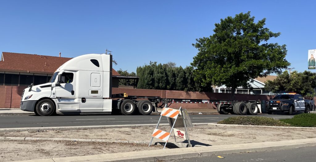
Trucks are permitted to use Santa Fe Avenue, one of the main corridors parallel to the 710 Freeway, only between the Pacific Coast Highway and Ninth Street — or for local pickups and deliveries — according to the municipal code. Yet Westside resident Mabel Martinez said it’s been common to see trucks on the avenue, even before the bridge closure. Now, residents are concerned drivers will use local streets rather than the designated detours along Anaheim Street and Harry Bridges Boulevard. West Long Beach is already one of the most polluted areas in the state, and truck drivers looking for a shortcut could make it worse.
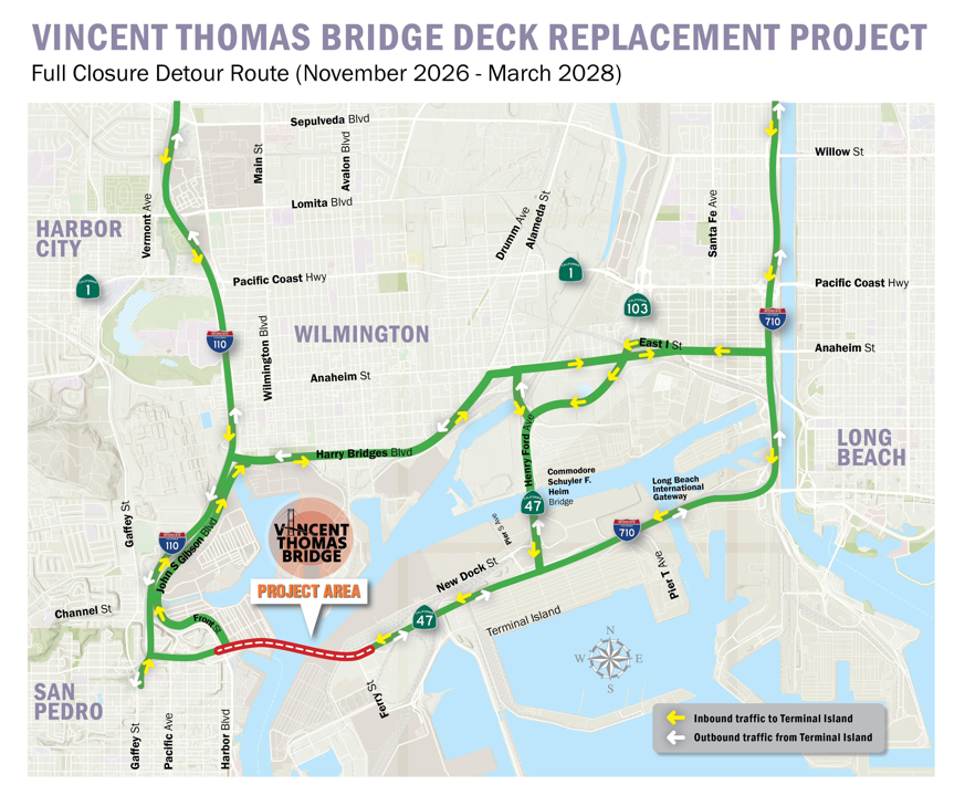
Martinez and other Westside residents are asking city leaders to intervene before the problem expands. They’ve requested more signage prohibiting trucks, a traffic study to understand neighborhood impacts and stricter enforcement of trucks driving where they shouldn’t.
An email from District 7 Councilmember Roberto Uranga’s office to community members acknowledged that trucks traveling on Willow, Santa Fe or State Route 103 — also known as the Terminal Island Freeway — are out of compliance. The email said that Uranga had discussed adding additional signage with the city’s Public Works Department. It’s unclear if or when that will happen. Public Works did not immediately respond to questions from the Long Beach Post.
The email said that although police are aware there may be more illegal truck traffic on the Westside, “the commercial enforcement team is small.”
Long Beach police declined to share how many trucks they have cited since the Vincent Thomas Bridge closed on Saturday. Martinez said she’s seen a police officer on-site more consistently, and another Westside resident, Jerlene Tatum, said she saw police stop a large truck on Santa Fe on Tuesday.
Vivian Malauulu, the District 7 Councilmember-elect who will assume office in December, said in a statement that she has begun meeting with local leaders and regional partners, including at the Port of Long Beach, to discuss the bridge closure’s effects on Westside residents.
“My goal is to ensure District 7 has a seat at the table throughout this project, not simply after problems arise,” she wrote.
Some residents are pushing for more drastic action to account for the years of neglect and pollution on the Westside. Life expectancy on the Westside is significantly shorter than that in East Long Beach neighborhoods, according to a 2022 report published by MemorialCare. In the 90813 ZIP code, which includes Westside South right next to the Port of Long Beach, average life expectancy is 71.9 years — compared to 80.2 in the 90803 ZIP code, which includes Belmont Shore and Naples.
The CalEnviroScreen, a granular mapping tool used by the state to evaluate pollution burden, shows that Westside census tracts bear some of the greatest pollution burdens in the state.
Dameon Gordon, a Westside advocate, said he knows it’s necessary to repair the Vincent Thomas Bridge’s deteriorating infrastructure but that “the communities surrounding the ports should not be expected to observe the additional pollution and congestion without meaningful mitigation.”
He suggested installing air quality monitoring stations and traffic signals to reduce congestion.
After years of being overlooked, Westside residents said they’re not willing to wait any longer. “The community wants to be proactive,” Martinez said, “to make sure that everybody’s safe and everybody’s following the rules.”