

Learn more about what El Niño means for Long Beach and how you can be prepared at LBPost.com/elnino. Support useful, community-centered reporting like this with a donation.
After weeks of stifling heat, Long Beach is preparing for a different kind of weather: powerful southerly swells, followed by rain showers as early as Saturday, all courtesy of a hurricane expected to make landfall in California this weekend.
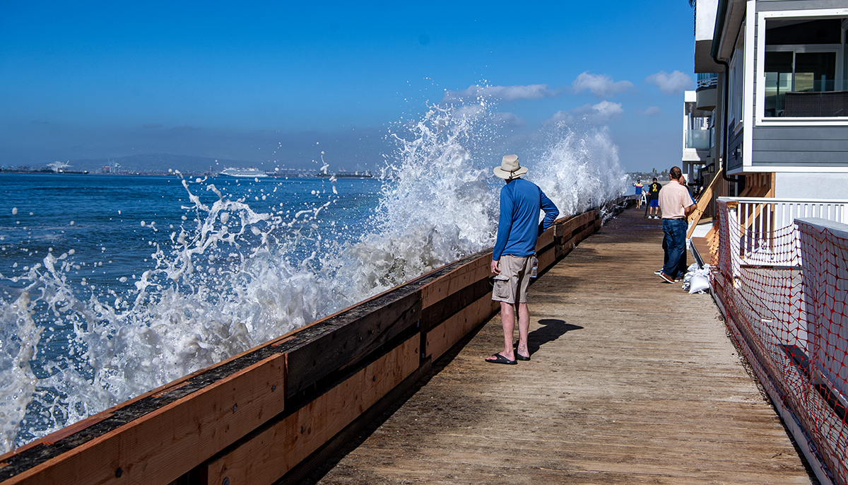
Waves arrived along the Peninsula on Wednesday — sending water onto the boardwalk and side streets — and returned Thursday, slapping against the already weakened bulkhead that serves as the last line of defense for a number of beach homes.
With a coastal advisory in effect through Friday, experts say 3-to-6-foot waves are being carried to shore by tides reaching 7 feet high and leaving behind dangerous rip currents.
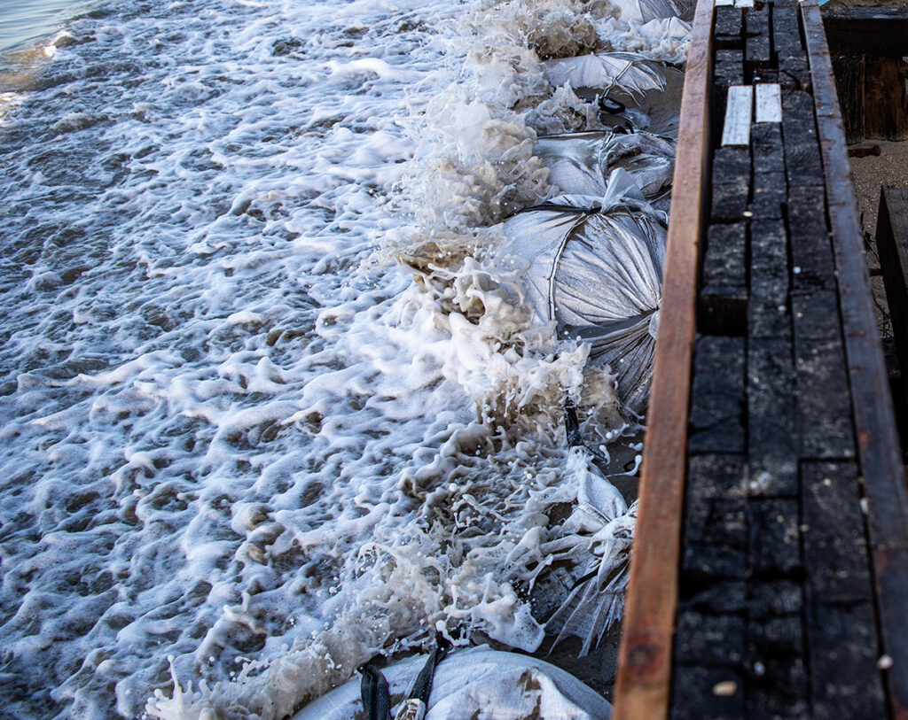
City crews were busy the past several days stowing hundreds of sandbags beneath the boardwalk as a second barrier, with emergency pumps ready. The work is complicated by the short window between recurring high tides and a limited supply of sand.
“We’re just basically trying to create a buffer between that impact zone, the energy of the impact, and that wall,” said Marine Safety Chief Gonzalo Medina. “I do expect that we will see some activity and some water intrusion out onto the streets, certainly the boardwalk.”
Why is the Peninsula vulnerable to hurricane waves? An opening in the breakwater that protects most of Long Beach lets swells through if they’re coming from a certain angle to the south. Read more here.
Marine and fire crews are expected to stand by overnight to monitor water levels and assist residents.
The area has already been tested this year, taking damage from Hurricane Marie over Labor Day weekend, followed by Hurricane Polo in late September. The National Weather Service says this week’s flooding will probably exceed Polo’s but fall short of Marie’s.
Kristan Lund, a meteorologist with the NWS office in Oxnard, said swells are forecast to peak Thursday through Saturday during the morning and evening tides.
It’s another example of an abnormal season, Lund said, where tides are running 1 to 2 feet higher than usual, well “above the astronomical tide charts.”
Waves are being charged north by Hurricane Rachel, which is expected to weaken considerably before it makes landfall 100 miles south of San Diego early Sunday and reaches the California-New Mexico border by Monday.
In comparison to the 2023 tropical storm Hillary, which wrought widespread flooding that necessitated rescues in desert towns, Lund said this storm is farther south and entering at a more horizontal angle toward New Mexico.
But it’s still “hard to tell for right now” how the storm will progress, Lund said, saying higher-resolution models should be released Friday or Saturday that more accurately predict its path.
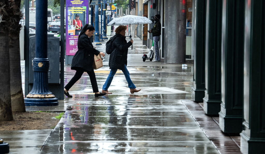
Forecasters say the system should still deliver heavy rain, gusty winds, dangerous surf and localized flooding, with hazardous zones stretching as far north as Orange County.
In Long Beach, rain could start as early as Saturday morning and linger through Tuesday night, with the best chance from Sunday morning through Monday evening.
Totals are expected to be modest, roughly a quarter to three-quarters of an inch, with a small chance of thunderstorms. South-to-west gusts of 20 to 35 mph are likely from Saturday through Monday, adding the risk of fallen trees and power lines.
Read more: How to report clogged drains or downed trees and spot flood-prone areas in your neighborhood
“The wind would actually be a lot more problematic than the rain,” Medina said. “You have a lot of trees already that we’re seeing, just from this heat, that have fallen. This heat has weakened the structure of a lot of these trees. And now you bring wind into the equation. The trees bring down power lines, and it gets complicated after that.”
Why is this happening?
The storm arrives at the tail end of a weekslong heat wave that experts say is a consequence of climate change compounded by El Niño, which has kept nights unusually warm and humid.
“At night it’s not cooling off as much, and that ends up being pretty consequential,” said Daniel Swain, a climate scientist with UC Agriculture and Natural Resources. “Because obviously the night is when people would usually cool down.”
El Niño also helps explain the high number of hurricanes and storm systems like Rachel and its predecessors, Swain said. “El Niño also increases hurricane activity in the eastern Pacific Ocean,” Swain said, describing a season that ranks as either the most or second most active on record depending on the metric.
The result has been repeated surges of tropical moisture toward Southern California, leaving humidity high.
Ocean temperatures off the coast are now about 7 to 8 degrees above average, and the Pacific from central Baja California to Southern California is at record warmth in data going back to 1982. Warm water expands, and a Kelvin wave, an underwater ripple that becomes “coastally trapped” as it reaches the Americas, can add 6 to 12 inches to background sea levels, potentially for months.
Swain said harbor masters and fire departments in coastal Los Angeles County have been calling him. “They’re like, ‘I’ve never seen water this high,'” he said, adding one told him it was the highest in 30 years, on a day that wasn’t supposed to be a particularly high tide.
And he expects it to get worse. “That’s something that’s actually going to get worse as we go into November and December.”
More Kelvin waves are expected this season, and scientists worry about one coinciding with a king tide, a major storm or both. The Climate Prediction Center is forecasting a wetter-than-average winter for Southern California, and Swain sees little doubt.
“All signs continue to point toward a very wet winter in coastal Southern California,” he said. “I would be very surprised if we did not have that.”
For now, the city is focused on the week ahead. Sandbag distribution sites open Thursday at 10 a.m. at Fire Stations 7, 12, 13 and 14, and at the Claremont Beach parking lot, through Tuesday.
Empty sandbags are available at all LBFD neighborhood Fire Stations. While the Claremont Beach Parking Lot (5400 E. Ocean Blvd.) site is offering sand and sandbags through Tuesday. Sand and sandbags are also available at the locations listed below starting Thursday, Oct. 8, at 10 a.m.:
• Fire Station 7 – 2295 Elm St.
• Fire Station 12 – 1199 E. Artesia Blvd.
• Fire Station 13 – 2475 Adriatic Ave.
• Fire Station 14 – 5200 E. Eliot St.
Find more ways to be prepared at LBPost.com/elnino